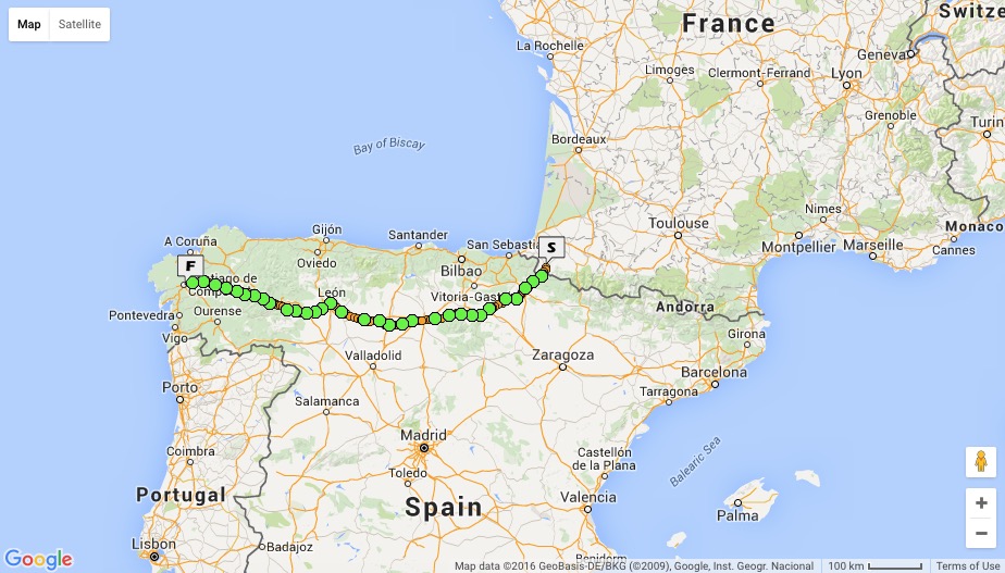
The Camino Francés, also known as the French Way, runs from Saint-Jean-Pied-de-Port in south-western France to Santiago de Compostela in north-western Spain. Below is a map of the route I followed (click on the map for a zoomable version).

Guide books and maps
John Brierley’s Camino de Santiago Maps is a useful and ubiquitous guide to the Camino Francés. “The maps show the location of all pilgrim hostels en route, the distances between villages, and points of interest, as well as counter guides, alternative routes, and accommodations.” It’s revised frequently. I used it before I left Australia as an introductory guide to the Camino — to get my head around the route, particularly the elevation profiles, distances and accommodation options. I didn’t take it with me because I found some good downloadable maps online that I put on my phone and they didn’t weigh anything …
In Burgos I was browsing in a map shop and came across the recently published Michelin Camino de Santiago zoom map (Michelin Green Guide 160). It’s a booklet with large-format maps of the Camino stages. I bought a copy. It’s not as detailed as the Brierley guide, but it’s cheap (€6), lightweight and easy to use.
