Origins of the suburb
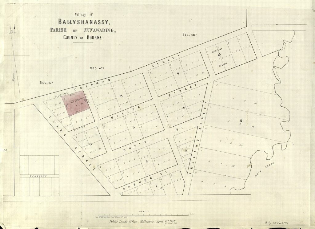
The origins of current day Burwood lie in the village of Ballyshanassy surveyed in 18581.
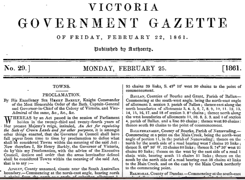
Ballyshanassy was proclaimed a town on 18 February 18612.
The name Ballyshanassy was a composite of ‘bally’, the Irish word for town, and ‘shanassy’, after John O’Shanassy3 the second Premier of Victoria.
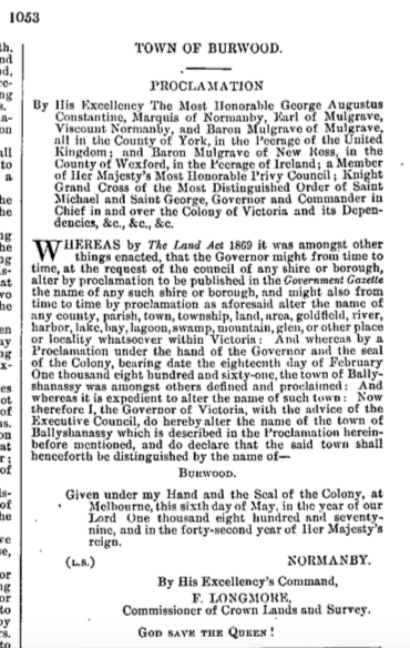
Moves to rename Ballyshanassy to Norwood were apparent in the years after 18614, but Norwood was never formally proclaimed. Ballyshanassy’s name was eventually changed to Burwood on 6 May 18795.
Origins of the name
Burwood is generally considered to have been named after the Hawthorn house — ‘Burwood’ — of Sir James Frederick Palmer (1803–71), itself likely named “after a place in the old country”6 7 8. Palmer was the Lord Mayor of Melbourne in 1845–46 and the first Speaker of the Victorian Legislative Council in 1851.
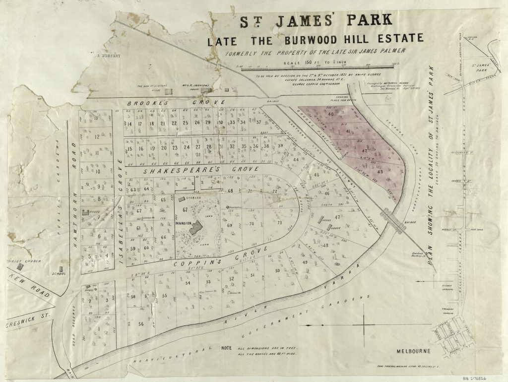
The land on which Palmer’s house was built — bounded by Burwood Road (Hawthorn Road on the following locality plan9), Yarra Street (Brookes Grove) and the Yarra River — was subdivided after his death in 1871 by George Coppin, the area becoming known as St James Park and the house (at 21 Coppin Grove) Amoe. After Coppin’s death in 1906 the house was sold and its new owner, Sir William McPherson, renamed it Invergowrie10.
Boundaries
Burwood’s boundaries are somewhat irregular11:
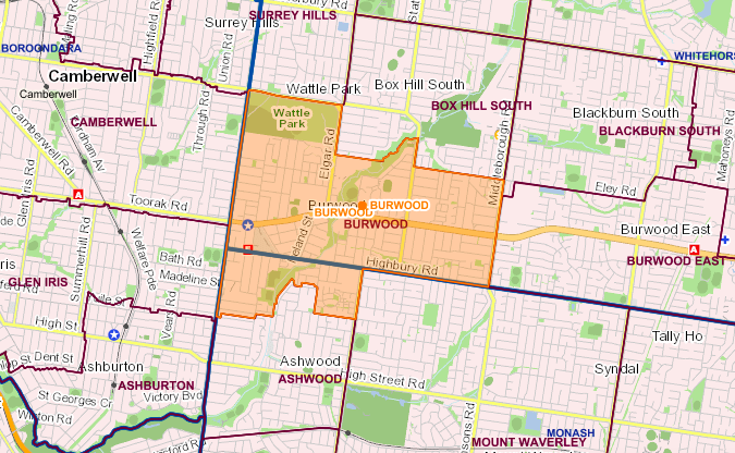
The suburb is bounded “to the north by Riversdale Road, the northern boundary of Deakin University, Gardiners Creek and Eley Road, the east by Middleborough Road and to the west by Warrigal Road. The southern boundary runs near to Carlyle and Zodiac Streets, then along Gardiners Creek and subsequently, in approximate alignment with Ashwood Drive, Montpellier Road, Arthur Street, Huntingdale Road and Highbury Road.”12
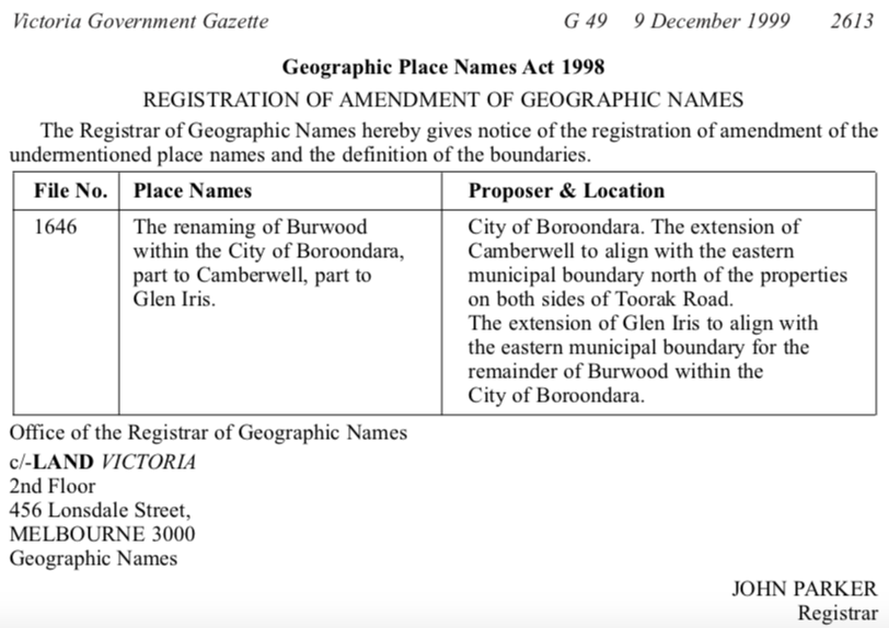
Burwood straddles two municipalities: the area north of Highbury Road is in the City of Whitehorse; the area south of Highbury Road is in the City of Monash. The suburb also once extended into the City of Boroondara, but that part of Burwood was renamed in December 1999, part to Camberwell and part to Glen Iris13.
References
1 Public Lands Office 1858, Village of Ballyshanassy, Parish of Nunawading, County of Bourke, State Library Victoria, viewed 3 January 2019, http://handle.slv.vic.gov.au/10381/174007.
2 Victoria Government 1861, Second Supplement to the Victoria Government Gazette, no. 29, p. 401, State Library Victoria, viewed 3 January 2019, http://gazette.slv.vic.gov.au/images/1861/V/general/29-a.pdf.
3 Lemon, A 2008, Burwood, School of Historical & Philosophical Studies – The University of Melbourne, viewed 5 January 2019, http://www.emelbourne.net.au/biogs/EM00268b.htm.
4 Lemon, A 1978, Box Hill, Box Hill City Council in conjunction with Lothian Publishing, Melbourne.
5 Victoria Government 1879, Victoria Government Gazette, no. 50, p. 1053, State Library Victoria, viewed 3 January 2019, http://gazette.slv.vic.gov.au/images/1879/V/general/50.pdf.
6 Geographic Names Victoria 2011, VICNAMES – The Register of Geographic Names : Historical Information : Burwood (Registered), State Government of Victoria, viewed 4 January 2019, https://maps.land.vic.gov.au/lassi/VicnamesUI.jsp?placeId=100587.
7 O’Callaghan T 1918, Names of Victorian railway stations : with their origins and meanings, together with similar information relative to the capital cities of Adelaide, Sydney, Brisbane, and a few of the border stations of New South Wales and South Australia, Royal Historical Society of Victoria & Victorian Railways, Government Printer, Melbourne.
8 Saxton J 1907, Victoria place-names and their origin, Saxton and Buckie, Clifton Hill [Melbourne].
9 Anon 1871, St. James’ Park, late the Burwood Hill Estate [cartographic material], State Library Victoria, viewed 4 January 2019, http://handle.slv.vic.gov.au/10381/166911.
10 Hawthorn Heritage Study—21 Coppin Grove, “Invergowrie” 1992, Heritage Victoria, viewed 22 June 2019, http://images.heritage.vic.gov.au/attachment/32345.
11 Geographic Names Victoria 2019, VICNAMES – The Register of Geographic Names : Places : Burwood (Registered) (Locality), State Government of Victoria, viewed 4 January 2019, https://maps.land.vic.gov.au/lassi/VicnamesUI.jsp?placeId=100587.
12 Burwood, Victoria 2018, viewed 4 January 2019, https://en.wikipedia.org/wiki/Burwood,_Victoria.
13 Victoria Government 1999, Victoria Government Gazette, no. G 49, p. 2613, State Government of Victoria, viewed 26 June 2019, http://www.gazette.vic.gov.au/gazette/Gazettes1999/GG1999G049.pdf.
